|
|
||||||||||||||
|
|
Mapping & SurveyOM UAV Systems offers comprehensive range of survey and mapping services which can be extremely useful e.g.
The survey using drones are very fast and cost effective besides being accurate and free from dangers and errors involved with human surveys in any dangerous territories like swamps, coastal region, mountains, mines etc. Drone imaging modernizes surveying and delivers invaluable insights to architects, engineers, contractors, civil authorities. The survey by drone is also very cost effective since such surveys were earlier carried out using helicopter and aircraft which were very expensive and also required lot of permissions to fly such aircraft. The major benefits:
MethodologyWe can use very highly accurate RTK/PPK GPS and ground control point to get very accurate images. Our drone platforms are equipped with mission planner software that automatically charter the drone path over the area to be surveyed. The software is intelligent enough to automatically deduce the grid points where images have to be taken so as to ensure user specific overlap percentage of images. The flight path is automatically adjusted based field of view FOV of the camera used and the height of the mission. The images are geotagged with the help ground control points and RTK/PPK GPS. The images are fed into industries standard photogrammetry software to deliver user specific output. Possible Output Format
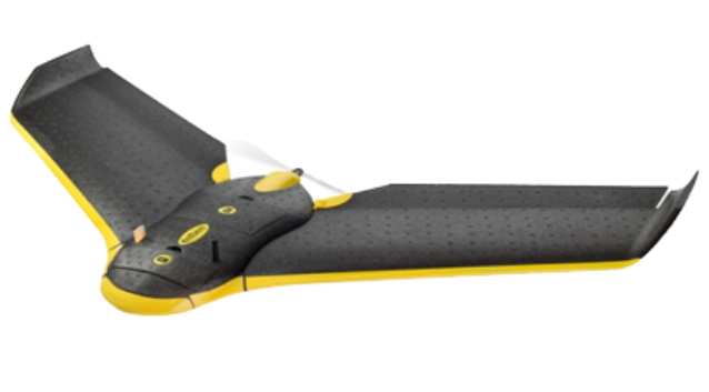
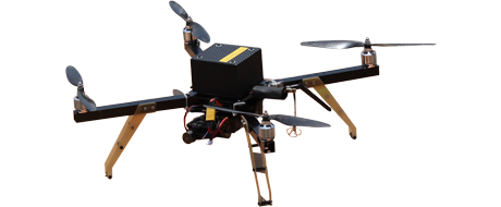
We can use Lidar, infrared/thermal camera and other high definition video/static cameras to capture accurate images and convert to 2D, 3D maps that can be annotated to do volumetric calculations. The software capabilities at OM UAV allow the measurement of distances and volumes, topographic, hydrographic and thermal maps, and the ability to see volumetric calculations for stockpiles. Such images can be compared over time to see the volumetric differences or change in topology or encroachment. We have both Fixed Wings and Multi Rotor drones to carry out such surveys. We can also mount user images equipment upto 10kg weight for custom surveys. |
|||||||||||||
|
||||||||||||||


