|
Civilian Applications
UAV application is useful for:
| Civilian: |
- Package delivery
- Mining
- Surveying
- Facility Surveillance
- Infrastructure Inspection
- Transmission Lines
- Disaster Management
- Agriculture
- Municipalities
- Traffic Management
- Dams and Hydropower stations
- Medicine/Organ Transportation
- Fire and Emergency
- Search and Rescue
- Wild Life
- Pilot Training
|
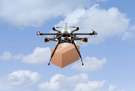
| Package delivery: |
|
Drones are vehicle of choice to manage package delivery in fastest possible manner, avoiding traffic jams. Drones can take off and land on roof tops and can carry multiple packages. Currently the capability to deliver does exist however due to flying limitations imposed by various agencies, this has not commercially taken off. However, it is very clear that this is the future and companies are gearing up to be ready when such restrictions are lifted. The situation can be best compared to the driver-less car innovation just a few years back.
|
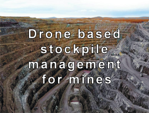
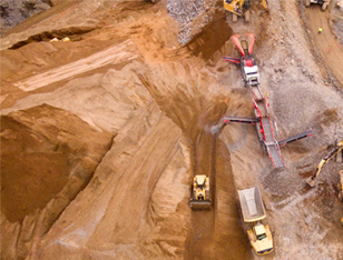
| Mining: |
Some of the issues in Mining sector involves surveillance, safety, inventory, stockpiles volume measurement, hotspot detection etc. Drones are extremely useful in each of the above area. Using drones it is possible to keep watch on vast area for pilferage. They are also very useful to study topology of the region to warn of future problem. Drones can take 3D image and using mathematical algorithm can estimates the volume of material in stockpiles. Such periodic measurement can be used to assess inventory line in the area.
Drones can also be used to plan safe blasting. These can also be used for pilferage detection.
Drones are very useful in case there is disaster as it can immediately provide an overview. Using a Infra Red camera hotspots can be detected in the stockpiles to avoid possible fire.
There is no better equipment than drone for safety, security, planning and stock estimation than drone.
Drones can be made to fly in autopilot mode in a grid fashion in a specified area without human intervention. Drone can take HD pictures at each grid points and then using specialized software the image can be stitched to provide terrain map in 2D and 3D.
|
|
| Surveying: |
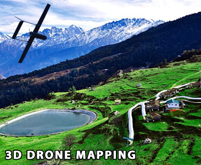
|
There is a regular requirement to map the topology for planning infrastructure projects, safety, disaster management etc. Traditionally foot soldiers were used to do such mapping. Lately satellite images or camera mounted on a plane or helicopter are used for such mapping exercise. Each of such modes of mapping is expensive, time consuming and requires lot of planning.
Drones can be effectively flown in autonomous mode in a grid fashion. Drones can be programmed to take still images in high definition at every grid points at pre-defined height and pre-defined overlap image percentage with neighboring grid point.
All these pictures are fed into specialized software to generate the 2D/3D maps. In case of drones the time from planning to execution is drastically reduced and that too at a fraction of cost.
|
| Facility Surveillance: |
In case of large facilities like refineries, power plant, automobile manufacturing units etc. the parameter of the facilities could run into kilometers. Traditionally watch towers with guards posted around the clock keep watch on the perimeter. However, such methods are cumbersome expensive and totally dependent upon alertness of the duty staff. In places where intelligent fences or parameter security gadgets are installed it only detects intrusion when it happens. It does not inform if there is anything wrong around the perimeter ahead of actual intrusion.
Drones are a huge force multiplayer for such facilities. It can be flown close to the ground or high enough that these are not audible, visible to people of the ground. Using an Thermal camera the guard can quickly investigate any trouble spot without physically going there. Drones can also be used to keep a watch on area outside the boundary wall to detect any possible threat that may be waiting to happen, for example, assembly of people, unidentified machinery, digging etc.
Drones can be programmed to autonomously take off at a pre defined interval and cover the parameter and again land without any human intervention. Alternately, this can be on standby to reach trouble spot to get instant video playback for the senior management to assess and take action.
|
|
| Infrastructure Inspection: |
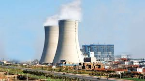
|
In large installation like refineries, power plant, railway shed etc. there is a requirement to continuously to keep vigilance on the infrastructure including pipes, chimneys, conveyor belt, hopper etc. however, many of such equipment is quite high and it is not possible for humans on ground to detect various problems that may be waiting to happen, for example, small cracks in chimneys, leak in steam or gas pipelines, pilferage from pipelines etc.
Drones are ideal for such inspection since they can be flown at any height and using pan, tilt, zoom capabilities, it is possible to view and magnify various spots. It is also possible to save such pictures for comparison in future. The bigger advantage is that multiple people can view the images in real time and take quick decision to avoid disaster in future.
Using a thermal camera it is possible to detect hotspot or trouble point much before they become a disaster.
|
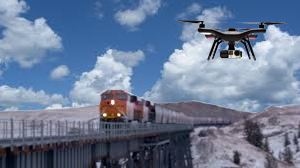
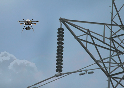
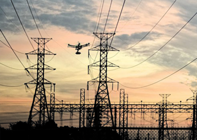
| Transmission Lines: |
With thousands of kilometers of transmission line crisscrossing country, it is becoming impossible to do preventive maintenance and ensure healthy transmission lines at all times. The usual problem in high voltage transmission line like cracked insulator, dust accumulation on insulator, hotspot on the line required early detection so that the transmission lines can remain operational. Traditionally the foot soldiers carry a binocular to view insulator at each of the transmission tower. The approach has a fundamental problem that it is only possible to see underside of the insulator.
Sometimes back planes were utilized where a person armed with zoom would take image of the insulators. However, this was very expensive and required the plane to be flown at a reasonable distance from the transmission line so that the plane may not get affected by magnetic field of the transmission line. It also requires clearance from air traffic controller, which was not easy.
Drones are very simple, safe, economical and extremely effective way to inspect transmission line from all angles. This can also be flown along the line at say 10 meters away from the transmission line. Since the multi-rotor drone can be flown for few kilometers and endurance of around 30 to 40 minutes, it is not necessary that a person has to go from tower to tower. The pilot can stay at one location and cover the towers in next couple of kilometers. It is also not required to go right up to the tower to take image since towers many times are on mountain slop or in inaccessible area. The pilot could sit even in his vehicle on nearby road and do the survey without risking his life through the fields or go to inaccessible tower base.
Drone with a thermal camera is an ideal choice to detect hotspot of transmission lines.
|
|
| Disaster Management: |
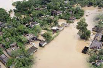
|
Disaster can happen any time, at any place. The only way to reduce impact of the disaster is to survey for possible trouble spots before disaster strikes or provide quick and effective relief post disaster. As obvious, to provide effective relief, it is important to identify whom and where to provide the relief. Drones can be very effective to look for survivor. It can go over the top and beyond fallen buildings, detect human person in flood hit area houses, go on the other side of a landslide, inspect vehicle fallen into ditch, warn about accumulated water on a clogged stream etc.
Drones should be mandatory equipment with each disaster team so that drone can be launched immediately on reaching the trouble spot to survey and prioritize the relief operation.
Drone with thermal camera can immensely help in detecting human bodies in dark.
|
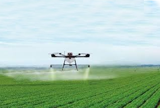
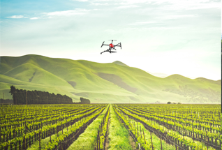
| Agriculture: |
It is general feeling that drone do not have much role in farming. However, drones have proven extremely useful in following areas:
i. Pesticides spray/Manure spray
ii. Survey for moisture content
iii. Spray on fruit trees, to name a few.
Pesticides spray/Manure spray
Drone with a insecticide/manure tank can be used to spray insecticides over an acre in 15 minutes. Traditionally the farmer has to wade through the crop to do this spray but this has multiple short coming like:
• Uneven spray
• Threat from snakes etc. in the field.
• Excess spray
• Harmful inhalation of chemicals.
Drone sprays uniformly and can dispense the insecticides as per pre-defined calculation. This reduces cost as well as reduces the amount of insecticides in the crop.
The biggest advantage is that the crop sprayer does not have to inhale the potentially harmful fumes and thus save himself from long term permanent health damage.
Survey for moisture content
Drone can analysis the moisture content in the land. Based on the findings the farmer can water the plant more or less as per the finding from drone leading conservation of water. Huge quantity of ground water can be saved if reasonable number of farmers adopt this approach.
Spray on fruit trees, to name a few.
Tall trees that bear fruits like mango, apple etc require insecticides spray which is not effective while standing on ground using ladder. Drone can very quickly spray tall trees from above and that too uniformly and effectively.
|

|
| Municipalities: |
|
Municipalities face huge challenge to detect encroachment. Drone can be used to keep check on illegal construction activities, encroachment, unauthorized dealing etc. periodically records can be kept and compared to present quote evidence.
Drones can also be used to survey pollution coming from industrial plants, air or water.
|
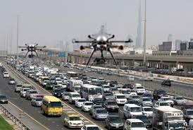
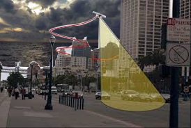
| Traffic Management: |
One of the biggest threat today is from vehicle emission. While it is simply impossible not to use vehicles the Government has been mandating improvement of fuel and engines to reduce vehicle emission. While this is a welcome step, however, similar result can be achieved by reducing the time the vehicle has to be on road. This can be effectively done by reducing traffic bottlenecks. Currently the traffic cop standing at an intersection has no idea why the traffic does not move beyond the intersection. Then there are many spots in a city which face constant traffic jam but traffic police is unable to identify the reason for the same.
Drones are indispensable in analysis of the traffic bottleneck since it gives clear overview of what is causing the traffic jam. Imagine if drone can be sent to identify the reason of the jam, the traffic cop then probably does not have to stand at the intersection but go the trouble spot and clear the jam. It is known fact that people do follow the rules unless they are forced to stop for long time at traffic junctions. Better traffic management shall also lead to better traffic rules compliance.
|
|
| Dams and Hydropower stations: |
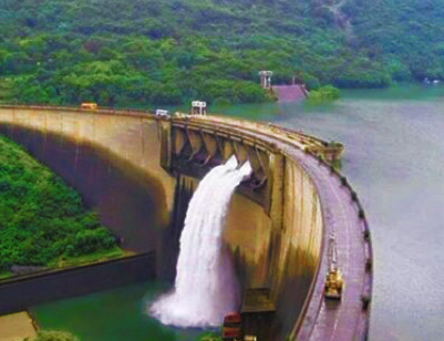
|
Drone can be very effective to do survey of catchment area. This can be done to detect landslide, excessive snow built up, and estimation of water flow. Such survey can also be used for safety purpose to preventive sabotage.
Drones are also very useful to inspect slipways since they can transmit images in high definition. Progressive images can be kept to see the progress of cracks or damage over period of time.
|
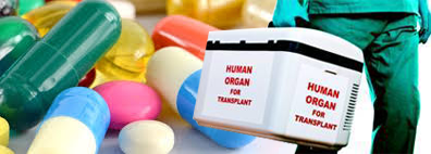
| Medicine/Organ Transportation: |
As has been seen in recent times that for transfer of organs from donor to recipient, the traffic police had to cordon off various road intersections so that the ambulance could quickly reach the other hospital. Such coordination by various agencies to stop traffic for quick movement is very cumbersome and hence rare.
On the other hand a drone could conveniently carry the organ or medicine from say one hospital to another hospital without disturbing the traffic.
|
|
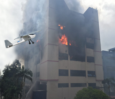
| Fire and Emergency: |
|
In case of fire especially in high-rise buildings it becomes difficult to find on which floor people are trapped. There is a possibility of people assembling on rooftop which cannot be seen from ground.
A drone can be launched from such emergency side to quickly go around the building and assess where the people are trapped. The relief operation can then be pin-pointed for affected area.
|
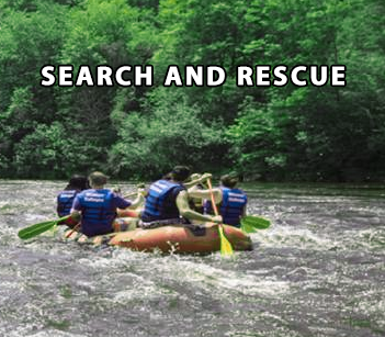
| Search and Rescue : |
There are many situation in which it is not easy to search for someone who may be lost for example a tracking team could have lost way on the mountain or the team could have been swept by an avalanche or people stuck in the trees in middle of flood waters etc.
A drone can quickly be deployed to survey the inaccessible area and help detect presence of human bodies. It can also be flown during night when it can detect using thermal camera. Drone helps to save precious time and not wait for rescue team to be deputed.
|
|
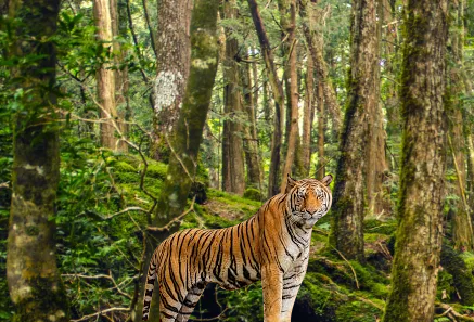
| Wild Life: |
|
Drones are very effective to track wild life. Regular survey by drone can detect any poachers or unauthorized vehicles in the forest. It can also be used to detect movement of animals. Thermal camera can detect human as well as animals who may be hidden in bushes.
Drones can also be useful to detect forest fires in the beginning itself so that corrective action can be taken before a major disaster.
|
| Pilot Training: |
|
OM UAV has specialized structured course for pilot training for drones/UAVs. The pilot training has various modules covering principles of flight, avionics, autopilot and sub systems, mission planning and tracking, trouble shooting. Besides class room training we have 20 acre test field where future pilot can experiment and train on actual drones. The training ground has a takeoff/landing strip to train pilot for fixed wing drone. Pilot are given chances to train on small drone with limited capability and depending upon their ability to learn, they graduate to larger fully equipped drones.
|
|
|